


The signs are everywhere. On July 11, meltwater from upstream of Kangerlussuaq, west Greenland, spectacularly washed out a bridge. Videos show the Watson River overwhelming the bridge and tossing a tractor as if it were a child’s toy.
On the same day, the Summit camp in central Greenland was in the midst of a record four-day stretch with temperatures above freezing. At more than 10,000 feet above sea level, Summit is usually the coldest and driest place in Greenland. But as warm air washed over it, snow began to melt, waterlogging researchers’ boots and making it impossible for resupply planes to land on the once-frozen runways. The last time Summit melted like this was in 1889, ice cores show. On average, these island-wide melts happen about once every 150 years.
So where did the warm air come from? According to NASA, ridges of warm air have been passing over Greenland since late May. An even warmer one began moving onto the island on July 8. By July 12 it had melted nearly all of Greenland’s surface ice, according to remote-sensing microwave and radar data.
This kind of widespread thaw has never been seen in the satellite era, NASA says. An atmospheric pressure pattern known as the North Atlantic Oscillation set the stage for more warm air to flow along the west coast of Greenland. At the same time, Greenland’s ice has been getting darker, thanks to a combination of factors such as more bright snow melting away every year as well as changes in snow grain shape and size that end up absorbing more sunlight. A new scientific paper, to appear in The Cryosphere, even predicted before the July thaw that total surface melt could happen over Greenland within a decade.
Summit and other areas refroze after the warm air moved away. But in the long term Greenland’s ice is still vanishing. Its outlet glaciers, which flow into the sea and thus directly contribute to sea level rise, have been speeding up. Its ice sheet, overall, has been losing mass at an ever-faster rate. And melt rates for June and July 2012 across Greenland far outstrip melt rates from previous years — including the record set in 2010, according to Marco Tedesco of the City College of New York.
Computer modeling by Tedesco and Xavier Fettweis of the University of Liège suggests that two regions are particularly sensitive to rising global surface temperatures. The first of those is southwest Greenland, along which warm air can easily be circulated. The second is northwest Greenland, which is especially influenced by thinning and shrinking Arctic sea ice. (Sea ice coverage has been tracking at levels far below average through July. Melting began earlier than normal through most of the Arctic.)
Indeed, northwest Greenland is where the summer’s latest meltdown took place. On July 16, a chunk of ice twice the size of Manhattan broke off the Petermann glacier, which two years ago had calved another huge iceberg.
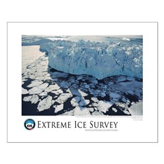
Hoping to catch such events as they happen, the Extreme Ice Survey installed two time-lapse cameras above Petermann in 2011. But it will take an $80,000 helicopter ride to retrieve the cameras and get a close-up look at what really happened. For now, Petermann is keeping its secrets.
 © 2012 Extreme Ice Survey
Help Keep Our Cameras Running by donating to our non-profit, EarthVisionTrust.org.